Geographic Information Systems (GIS) Data Pathfinder
Geographic Information Systems (GIS) Data Pathfinder
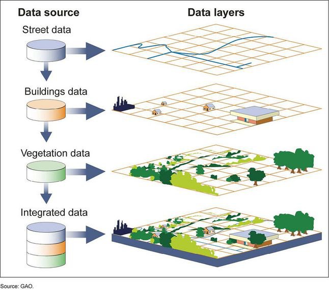
Geographic Information Systems (GIS) are used in nearly all fields that need to understand the spatial patterns and relationships between different types of data, from land-use planning to emergency response to resource management. GIS include many components: visualizations through interactive maps, data based on the location of features or variables represented, spatial analytic functions that focus on identifying trends and patterns across space and time, and applications that enable tools and services in user-friendly interfaces.