PIA24909: MISR Captures Hurricane Ian
Oct. 14, 2022, 11:59 a.m.
Project: MISR
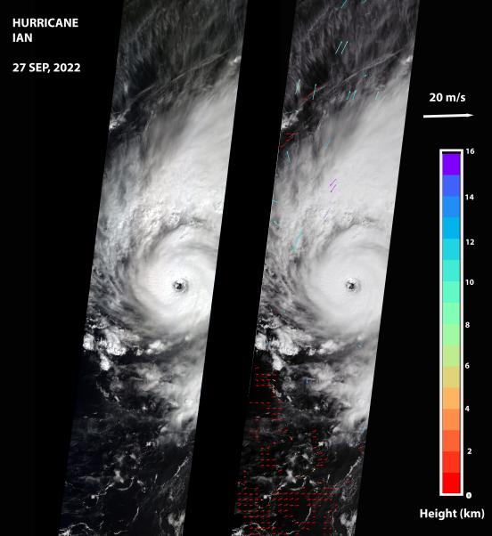
NASA's Multi-angle Imaging SpectroRadiometer (MISR) captured an optical image of Hurricane Ian, as well as measurements of the storm's wind speed, at noon local time Sept. 27, 2022. The storm, a Category 3 hurricane at that time, had maximum sustained winds of 115 mph (185 kph). The eye of the storm was located off the northern coast of Cuba, approximately 70 miles (110 kilometers) west of Havana, after passing over the island in the morning hours.
The MISR instrument, flying aboard NASA's Terra satellite, carries nine cameras that observe the Earth at different angles. It takes approximately seven minutes for all the cameras to observe the same location on the Earth, and the motion of clouds during that time is used to calculate wind speed at the cloud tops. The left-hand panel of the first figure shows an image of the storm as viewed by MISR's central, downward-looking camera. The panel on the right shows the wind speeds derived from MISR data superimposed on the image. The length of the arrows is proportional to the wind speed, while their color shows the altitudes of the cloud tops in kilometers.
To read more go to: https://photojournal.jpl.nasa.gov/catalog/PIA24909
Image Credit: NASA/GSFC/LaRC/JPL-Caltech, MISR Team
Image Addition Date: 2022-09-30
Related URLS: https://asdc.larc.nasa.gov/data/MISR/